Location
Our woodland is on lower magnesian limestone and contains an archeological site. This site overlooks a narrow valley that leads into a larger gorge and sits on the edge of a fault scarp. A fault scarp forms when two pieces of land are separated: convection currents in the mantle cause an uplift of the land, resulting in an earthquake along a line of weakness.
LiDAR
LiDAR, Light Detection and Ranging, was used to create an image of our woodland for an archeological dig. LiDAR images are computer-generated, using data about the height of the ground. A laser is used to emit light, normally from a plane or helicopter. The time taken for the light to reflect back and the amount of light that was detected at the same time, tells us where hills and flat ground are.
LiDAR Image
Red=Rectangular enclosure
Blue=Larger rectilinear enclosure
Green=Small limestone quarry
Yellow=Drainage ditch
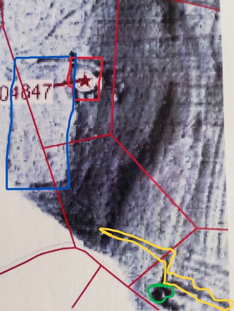
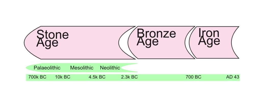
The larger enclosure shown above appears to be a prehistoric field. Prehistoric refers to what happened before records were kept. This does include dinosaurs, but in the case of the archaeological dig it refers to the Stone, Bronze and Iron Ages.
The Previous Dig
The enclosure has an area of 407 m2 and is sub-rectangular, a rectangular shape with rounded corners. About 1.5 m apart, two parallel rows of limestone slabs, orthostats, form the enclosure. Inside each of these walls, limestone rubble was found. As the ground surrounding the enclosure is up to 1 m higher than the floor, the interior may be an eroded or excavated hollow. One of the finds was a fragment of a saddle quern, though the location of where it was found is unknown.
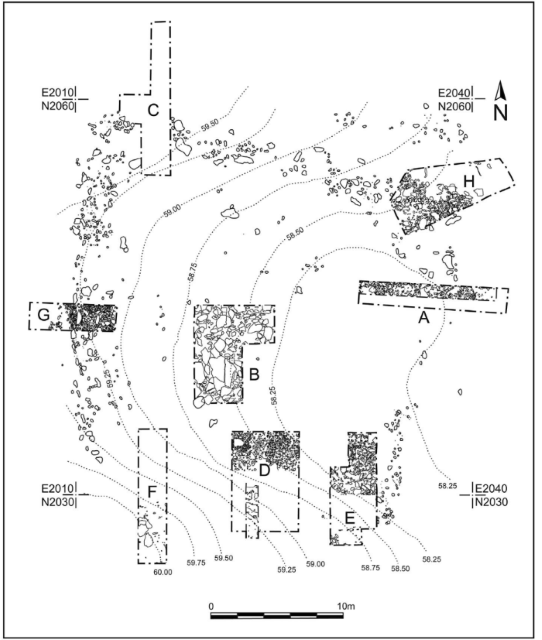
Trench A cut across inner and outer ditches of the enclosure.
During the previous dig, Trench B revealed cobbles on top of two rock layers, the top one had large, angular rubble in an orange matrix. Meanwhile, the lower one was yellower, and contained rocks disturbed by humans, slag and animal bones.
Trench C was by the enclosure’s bank, which was made up of rubble set into a top earthen bank. A drop in the height of bedrock around 2 m north from the enclosure’s outer edge suggests that Trench C is northern limit of the hollowed-out area that was around before the enclosure.
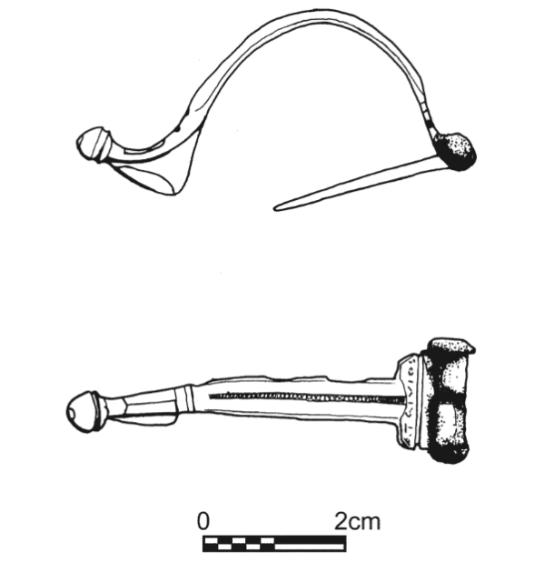
The upper layer of Trench D was home to Roman finds, including a brooch and a fragment of a colour-coated breaker.
Trench E was an excavation of possible inner and outer ditches.
Trench F uncovered bone fragments, struck flints, an arrow head and pottery sherds.
Trenches G and H revealed orthostats.
Next Steps
Now, we’re going to continue the unfinished dig, starting with the investigation around the orthostat in the north-west corner by Trench C. A very old dog will be supervising our work!